
Compare Maps in QGIS with QMapCompare
What you'll learn
- How to compare multiple maps in QGIS with the QMapCompare plugin
- How to install QMapCompare
- How to use the comparison modes: mirror, split, and lens
Recommended for
- Anyone who wants to compare different map data in QGIS
- Anyone who wants to visually check the differences between satellite imagery and basemaps
- Anyone who wants to compare maps from before and after a disaster, or past maps
Introduction
When you use QGIS, you often switch between several background maps. But if you can display only one map at a time, comparing fine differences can be hard.
Several web tools let you compare maps in different styles, such as Japan's “Konjaku Map on the Web” and “Remonter le temps” from France's IGN (the equivalent of the Geospatial Information Authority of Japan, or GSI). Until now, however, QGIS had no stable way to compare maps. So MIERUNE developed the QMapCompare plugin!
With this plugin, you can easily compare multiple maps in QGIS and visualize them in different display modes.
This article shows how to install QMapCompare and what it can do.
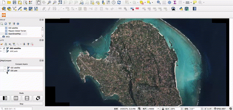
Install the QMapCompare plugin
First, install the QMapCompare plugin. QGIS 3.34 or later is required to install this plugin.
From the menu bar, click Plugins → Manage and Install Plugins.

The Plugins dialog opens. Follow these steps to install QMapCompare.
- Select the All tab.
- Enter
QMapComparein the search field. - Select QMapCompare from the list.
- Click the Install Plugin button.

When the installation finishes, QGIS adds an icon to the toolbar. Click the icon to show or hide the QMapCompare panel.

How to use QMapCompare
The list below shows how to use the plugin. Select the layers to compare in item 1, then click one of the buttons in items 2 to 5 to display the map with that comparison method.
- Compare layers: Select the layers you want to compare (you can select more than one)
- Mirror: Shows two maps side by side
- Vertical Split: Splits the map into two vertically
- Horizontal Split: Splits the map into two horizontally
- Lens: Shows a circular preview around the mouse cursor
- Stop: Ends the comparison

Overview of the comparison methods
Mirror
A map view of the same area appears to the right of the map canvas.
This is useful when you want to compare different data, such as a basemap and satellite imagery side by side.
Split
The map splits in two, and the comparison layer you selected appears on the right. There are two types, vertical split and horizontal split, so you can use whichever suits your purpose.
This method is useful for comparing features from different datasets, such as OpenStreetMap building data and GSI Maps.

Lens
A circular preview appears around the mouse cursor and shows the comparison layer inside it. As you move the cursor, the contents of the circle change in real time.
This method is useful when you want to compare a specific location in detail, and it lets you check data dynamically and intuitively.
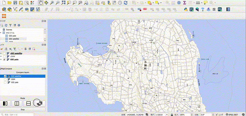
Ways to use the plugin
The practical features described above are useful in cases like the following.
- Comparing aerial photos from multiple points in time

- Comparing orthoimagery from before and after a disaster

Conclusion
QMapCompare is a plugin that lets you compare different maps and datasets in QGIS in a variety of ways.
With this plugin, you can make comparisons like the following at a glance:
- Comparing time-series data (such as maps from before and after a disaster)
- Comparing data quality (such as the accuracy of GSI Maps and OpenStreetMap)
- Supporting decisions (comparing different analysis results and checking differences in style)
QMapCompare is a newly released tool, so it may still contain bugs. If you find a bug or have an improvement to suggest, it helps when you report it here!

QGIS LAB is a comprehensive information hub for QGIS, the open-source GIS software. Under the concept of “Geospatial for Greater Good,” we share the knowledge and skills to open up the world through location data.


