
QGIS 3.38 New Features: Elevation Filtering
What you'll learn
- New features in QGIS 3.38
Recommended for
- Anyone interested in the latest QGIS features
Introduction
QGIS 3.38 “Grenoble” was released on June 21, 2024.
Grenoble is known as the “capital of the French Alps” and sits in a wide valley almost entirely surrounded by mountains. Fittingly, this version includes several improvements related to elevation.
This article introduces some of the new features from the changelog for QGIS 3.38.

Map tools
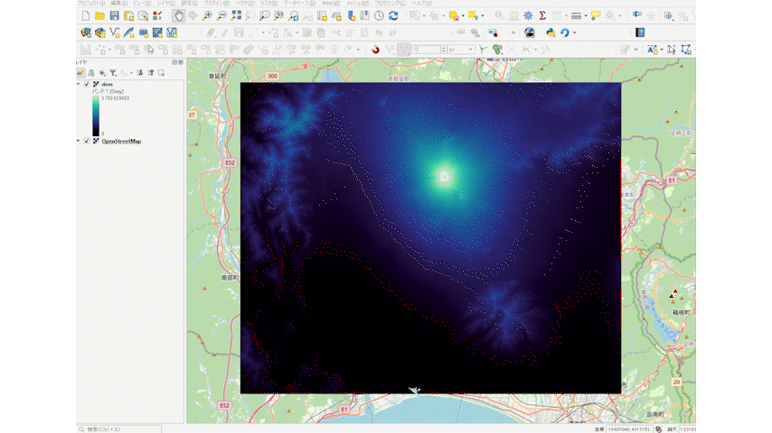
New elevation controller for filtering elevation data on 2D maps
The new elevation controller lets you filter elevation data on a 2D map. You can slice the Z range of elevation data with the same kind of operation as the temporal controller.
You can access this feature from the menu bar under View → Data Filtering, which also contains new menu items for the temporal controller.
The controller appears on the left side of the map as a range slider. It has an action for setting the project's elevation range, which determines the range available from the widget.
The elevation controller's configuration menu also has an option for setting a fixed elevation slice width. Use it when you want to display a specific elevation range width.
Labels
New “Over point” placement option for cartographic label mode
QGIS 3.38 adds a label placement option for when the label placement mode is set to Cartographic: the new option “O” (over point).
If you set the placement priority with an expression and list “O” first, the label is placed directly over the corresponding point.

Symbology
New single color renderer for rasters
QGIS 3.38 adds a Single color renderer to the symbology of raster layers.
It gives you a simple, easy way to render raster data in a single color.

Support for wind barbs showing wind direction and speed in mesh vector datasets
Wind barbs are a common way to show wind strength and direction visually on a map. The new wind barb symbology type makes it easy to use this visualization style with mesh vector datasets.
Wind barbs show wind speed in knots (nautical miles per hour), so for the data to display correctly, you need to select the data units explicitly or use a custom multiplier to convert the values to knots.

CMYK mode in the color picker
A long-requested feature, CMYK mode, is now in the color widget.
This makes print-oriented output possible and is a major improvement.

How to upgrade
The article below explains in detail how to upgrade QGIS. Have a look at it as well.
Conclusion
QGIS 3.38 makes major improvements to data filtering, particularly the filtering of elevation data, and the addition of CMYK support is also welcome. These are among the new features in this version, and the details are in the changelog.

QGIS LAB is a comprehensive information hub for QGIS, the open-source GIS software. Under the concept of “Geospatial for Greater Good,” we share the knowledge and skills to open up the world through location data.


