
QGIS 3.36 New Features: Richer 2D and 3D Maps
What you'll learn
- New features in QGIS 3.36
Recommended for
- Anyone who wants to learn about the new features in QGIS 3.36
Introduction
QGIS 3.36 “Maidenhead” was released on February 23, 2024.
The name comes from the Windsor and Maidenhead borough council, one of the first local governments in the UK to move to QGIS (version 1.8!) in 2010. The UK QGIS user group started there.
This article introduces some of the new features from the changelog for QGIS 3.36.

Symbology
Customizing raster fill symbols
The Raster Image Fill symbol type lets you set the width and height of the raster image independently. This makes raster fills even more flexible to customize.

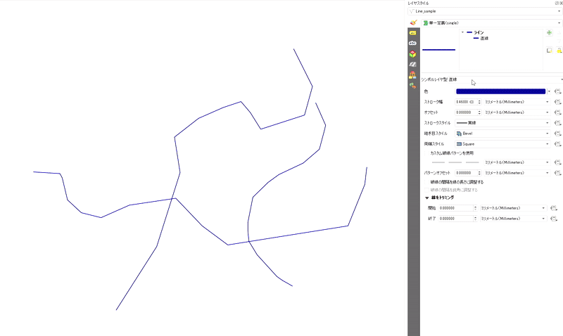
New Filled Line symbol layer type
You can now draw line layers with a fill. As with the Marker Line settings, you can customize styles such as hatches and gradients.
3D data
Improved Phong shader settings
The Phong shader is the default setting for displaying vector data in the QGIS 3D view. The shader now handles the ambient light and shininess parameters better, so they are easier to use.

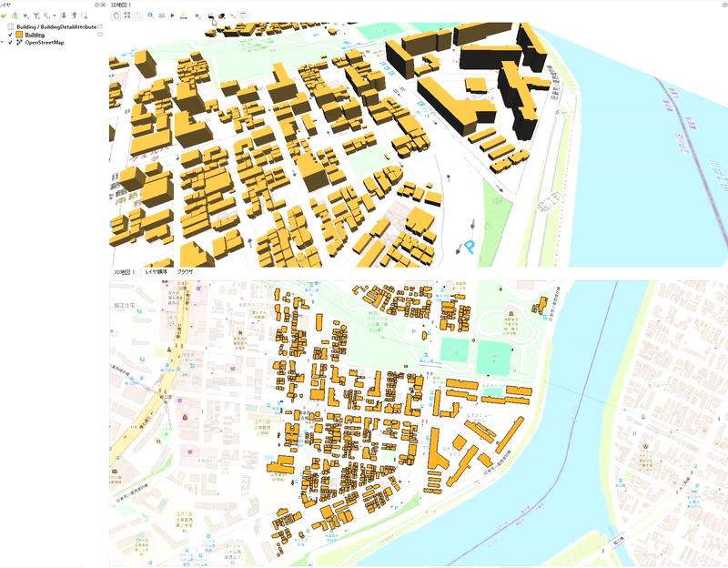
Shortcut to set the 3D scene extent on the 2D map
QGIS 3.36 adds a shortcut to the 3D map toolbar. It lets you quickly draw the extent of the scene on the 2D map.
Point cloud data
Rendering as a surface on 2D maps
QGIS 3.36 adds a Render as a Surface (Triangulate) option to the 2D styling of point cloud data.
With this option, QGIS renders triangles in real time instead of points. The color of each point is kept and interpolated within each triangle.

Faster rendering
Point cloud rendering is faster because QGIS now uses a cache that stores decoded nodes.
With this optimization, QGIS no longer has to decompress the same nodes again and again when you pan or zoom, especially with compressed data sources such as the LAZ format.
Improved classification flag attributes
LAS/LAZ files contain four flags for each point: synthetic, key-point, withheld, and overlap. In QGIS 3.36 and earlier, all of these flags were combined into a single value in the ClassificationFlags attribute, which was inconvenient when you wanted to use an individual flag for filtering or visualization.
Version 3.36 restructures these flags so that each is available as a separate attribute. This makes it easier to set up filtering and visualization, so the old ClassificationFlags attribute is removed.

How to upgrade
The article below explains in detail how to upgrade QGIS. Have a look at it as well.
Conclusion
QGIS 3.36 brings a variety of improvements to symbology, 3D data, and point cloud data. For details, see the changelog.

QGIS LAB is a comprehensive information hub for QGIS, the open-source GIS software. Under the concept of “Geospatial for Greater Good,” we share the knowledge and skills to open up the world through location data.


