
QGIS 3.30 New Features: Major Raster Updates
What you'll learn
- New features in QGIS 3.30
Recommended for
- Anyone interested in the latest QGIS features
Introduction
QGIS 3.30 was released on March 4, 2023.
As usual, the release includes a huge number of updates. This article picks three raster-related updates that stand out.
The release name “'s-Hertogenbosch” comes from a city of the same name in the southern Netherlands.


Raster MapTips
QGIS has a feature called MapTips, but until now it worked only with vector layers.
(A MapTip is the small display that appears when you hover the mouse over a feature.)

MapTips appear when Show Map Tips is on.

You can change the information shown in the layer properties.

QGIS 3.30 adds MapTips for raster layers!
Open the layer properties of a raster layer and go to the Display tab.

You control the display with the text you enter in HTML Map Tip. Start by entering the following:
[% raster_value( 'L03_b_14_5339_7f3bbcba_72d7_4acc_a63f_695b2ddf67e6', 1, @layer_cursor_point ) %]

The MapTip with the content you specified appears!

HTML Map Tip accepts an HTML template and QGIS expressions.
To look up the layer name, process the output value, or do something else, click the ε button to open the Expression Dialog. Enter the following in the expression form, then click OK, Insert, and Apply in that order.

Check attributes by hovering the mouse
Feature: Identify on mouse move, no mouse click
Next up is feature information!
When you click a feature, its attributes appear in the Identify Results panel.

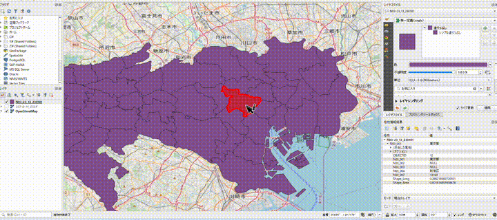
This update adds Identify Feature(s) on mouse over to the settings in Identify Results!

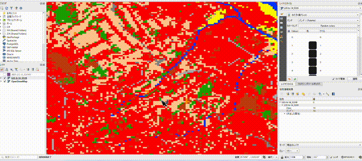
Turn it on, and you can see a feature's attributes just by hovering over it, as shown here!
It works with raster layers too, of course!
Attribute table support for raster layers
Feature: Raster Attribute Tables (RAT) Support
Right-click a raster layer in the Layers panel and click Open Raster Attribute Table.

The table lets you set values such as RGBA for each band and each pixel.

You can also check it in the layer properties.

The data used here is the Land Use Tertiary Mesh from National Land Numerical Information. The colors mean the following:

Because you can edit the RAT directly in QGIS, you can enter item names in Class and other columns, and you can add columns too.

You can create a RAT from the symbology or load one from a separate file.

A RAT is saved in a file named xxx.aux.xml and loads automatically when its prefix matches the raster layer's.
How to upgrade
The article below explains in detail how to upgrade QGIS. Have a look at it as well.
Conclusion
QGIS 3.30 adds many more features than the ones covered here. If you are curious, see the changelog!

QGIS LAB is a comprehensive information hub for QGIS, the open-source GIS software. Under the concept of “Geospatial for Greater Good,” we share the knowledge and skills to open up the world through location data.


