
QGIS 3.28 New Features: Vector Tile Selection
What you'll learn
- New features in QGIS 3.28
Recommended for
- Anyone interested in the latest QGIS features
Introduction
This article introduces some of the new features from the changelog for QGIS 3.28 “Firenze,” released on October 21, 2022.


Selecting features in vector tile layers
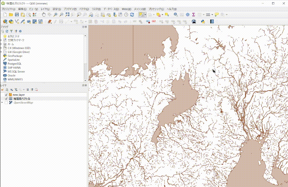
QGIS 3.28 lets you select features in vector tile layers. You can copy the features from any part of a vector tile layer and paste them straight into another layer.
Point cloud layer export
You can now export point cloud data loaded in QGIS. The export options let you transform the data to a different coordinate reference system (CRS), extract only the part within the boundary of a polygon in another layer, and filter the data, for example by limiting the number of points.

Eye dome lighting (EDL) for point clouds in 2D maps
The EDL effect for point clouds, previously available only in the 3D view, can now also be set for the 2D map from Symbology. Eye dome lighting (EDL) is a mode that emphasizes the outlines of a point cloud to give it depth.

Show in Attribute Table from the legend
QGIS 3.28 adds a Show in Attribute Table action for legend items, so you can open the attribute table from a layer's legend. The table opens filtered to the features that match that legend item, which makes it easier to find the data you are looking for.

The image below shows the attribute table opened from the 札幌市 (Sapporo) legend item of the Hokkaido administrative area data. The Advanced Filter (Expression) is applied by default.

Styling labels with HTML tags
Labeling now supports more properties of the HTML style tag. This release adds bold, italic, font size (to change the size of characters), and font family (to change the typeface).
This widens the range of styles you can apply to different characters within the same label. It would be nice to see even more style tag properties supported in future updates.

Confirmation dialogs as a safeguard
When you delete features on the map in editing mode, earlier versions showed a confirmation dialog only if the features to delete were outside the screen. In this release, the dialog always appears by default when you delete features, and it also shows the number of features to be deleted.
Mistakes like “I was editing and realized I had deleted extra features” become much rarer.

The expression editor also shows a confirmation dialog by default when you click the close button after changing an expression. This spares you from closing the editor by accident and having to rewrite a long expression.

How to upgrade
The article below explains in detail how to upgrade QGIS. Have a look at it as well.
Conclusion
QGIS 3.28 adds many more features than the ones covered here. If you are curious, see the changelog for details!

QGIS LAB is a comprehensive information hub for QGIS, the open-source GIS software. Under the concept of “Geospatial for Greater Good,” we share the knowledge and skills to open up the world through location data.


