
QGIS 3.26 New Features: Elevation Profiles
What you'll learn
- New features in QGIS 3.26
Recommended for
- Anyone interested in the latest QGIS features
Introduction
QGIS 3.26, released on June 24, 2022, adds useful new features for point cloud data and map styles.
This article introduces some of them.


Elevation profile plotting tool
The elevation profile tool, which was originally available as a plugin, is now built into QGIS as a core feature. It supports vector, raster, mesh, and point cloud data.

Cloud Optimized Point Clouds (COPC) support
The Cloud Optimized Point Cloud specification (COPC) stores point cloud data in an octree structure, so a client can extract just the part of the data it needs. QGIS can now display COPC data. You can load published COPC data from Data Source Manager → Point Cloud. The images below show sample data from the official website.


3D map views are easier to use
A 3D axis annotation is new in the 3D map view. In addition, when you set a 3D symbol to Follow 2D Symbology, changes to the 2D symbol are reflected dynamically in the 3D map view.
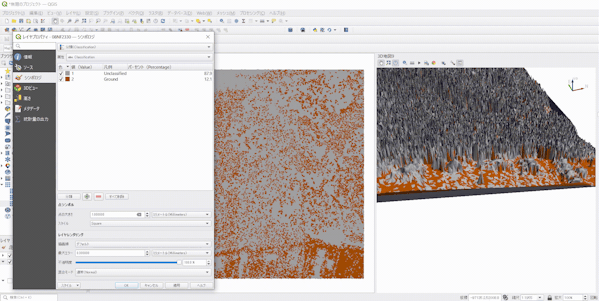
Triangulation rendering lets you interpolate a point cloud into a surface.
- Without interpolation

- After triangulation interpolation

Fixed interval classification for continuous values
Equal-interval classification was already possible before version 3.26, but QGIS 3.26 adds a Fixed Interval classification method. With it, you can classify using an interval size you specify.

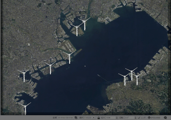
Animated markers
You can now set animated markers. GIF, WebP, and MNG files are supported.
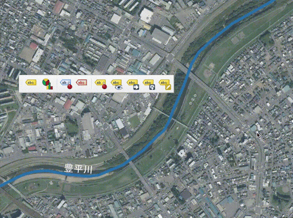
Moving labels along lines
This version adds the ability to move a label along a line. It helps when you place labels for features such as rivers and roads.
How to upgrade
The article below explains in detail how to upgrade QGIS. Have a look at it as well.
Conclusion
This article focused on updates to the elevation profile, 3D views, labeling, and symbology. QGIS 3.26 adds many more features than the ones covered here, so check the changelog as well.

QGIS LAB is a comprehensive information hub for QGIS, the open-source GIS software. Under the concept of “Geospatial for Greater Good,” we share the knowledge and skills to open up the world through location data.


